


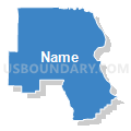
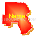
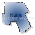
Cape Girardeau, Scott & Bollinger Counties PUMA, Missouri
About
Outline

Summary
| Unique Area Identifier | 193292 |
| Name | Cape Girardeau, Scott & Bollinger Counties PUMA |
| State | Missouri |
| Area (square miles) | 1,633.38 |
| Land Area (square miles) | 1,616.43 |
| Water Area (square miles) | 16.95 |
| % of Land Area | 98.96 |
| % of Water Area | 1.04 |
| Latitude of the Internal Point | 37.27559760 |
| Longtitude of the Internal Point | -89.78193530 |
Maps


Graphs
Select a template below for downloading or customizing gragh for Cape Girardeau, Scott & Bollinger Counties PUMA, Missouri


Neighbors
Neighoring Public Use Microdata Area (by Name) Neighboring Public Use Microdata Area on the Map
- Butler, Ripley, Wayne, Madison, Iron, Reynolds & Carter Counties PUMA, MO
- Dunklin, Stoddard, New Madrid, Pemiscot & Mississippi Counties PUMA, MO
- South & Southeast Illinois PUMA, IL
- St. Francois, Washington, Perry & Ste. Genevieve Counties PUMA, MO
Top 10 Neighboring County (by Population) Neighboring County on the Map
- Cape Girardeau County, MO (75,674)
- Scott County, MO (39,191)
- Stoddard County, MO (29,968)
- Perry County, MO (18,971)
- New Madrid County, MO (18,956)
- Union County, IL (17,808)
- Mississippi County, MO (14,358)
- Wayne County, MO (13,521)
- Bollinger County, MO (12,363)
- Madison County, MO (12,226)
Top 10 Neighboring County Subdivision (by Population) Neighboring County Subdivision on the Map
- Cape Girardeau township, Cape Girardeau County, MO (40,563)
- Byrd township, Cape Girardeau County, MO (18,646)
- Richland township, Scott County, MO (16,833)
- Kelso township, Scott County, MO (10,414)
- Tywappity township, Mississippi County, MO (6,514)
- Randol township, Cape Girardeau County, MO (4,431)
- Lorance township, Bollinger County, MO (4,366)
- Shawnee township, Cape Girardeau County, MO (3,910)
- Pike township, Stoddard County, MO (3,830)
- Duck Creek township, Stoddard County, MO (3,492)
Top 10 Neighboring Place (by Population) Neighboring Place on the Map
- Cape Girardeau city, MO (37,941)
- Sikeston city, MO (16,318)
- Jackson city, MO (13,758)
- Scott City city, MO (4,565)
- Chaffee city, MO (2,955)
- Marble Hill city, MO (1,477)
- Oran city, MO (1,294)
- Miner city, MO (984)
- Benton city, MO (863)
- Morley city, MO (697)
Top 10 Neighboring Elementary School District (by Population) Neighboring Elementary School District on the Map
- Nell Holcomb R-IV School District, MO (2,812)
- Kelso C-7 School District, MO (2,219)
- Altenburg 48 School District, MO (1,046)
Top 10 Neighboring Unified School District (by Population) Neighboring Unified School District on the Map
- Cape Girardeau 63 School District, MO (38,472)
- Jackson R-II School District, MO (30,067)
- Sikeston School District, MO (20,716)
- Perry County 32 School District, MO (17,763)
- Fredericktown R-I School District, MO (10,918)
- New Madrid County R-I School District, MO (9,385)
- Charleston R-I School District, MO (8,525)
- Woodland R-IV School District, MO (5,940)
- Scott County R-IV School District, MO (5,905)
- Greenville R-II School District, MO (5,601)
Top 10 Neighboring State Legislative District Lower Chamber (by Population) Neighboring State Legislative District Lower Chamber on the Map
- State House District 115, IL (105,561)
- State House District 118, IL (99,068)
- State House District 157, MO (37,900)
- State House District 158, MO (35,947)
- State House District 159, MO (35,685)
- State House District 156, MO (34,716)
- State House District 161, MO (34,576)
- State House District 160, MO (33,273)
Top 10 Neighboring State Legislative District Upper Chamber (by Population) Neighboring State Legislative District Upper Chamber on the Map
- State Senate District 58, IL (216,350)
- State Senate District 59, IL (209,843)
- State Senate District 27, MO (172,783)
- State Senate District 25, MO (169,588)
Top 10 Neighboring 111th Congressional District (by Population) Neighboring 111th Congressional District on the Map
Top 10 Neighboring Census Tract (by Population) Neighboring Census Tract on the Map
- Census Tract 8805, Cape Girardeau County, MO (9,040)
- Census Tract 8804, Cape Girardeau County, MO (6,908)
- Census Tract 8813, Cape Girardeau County, MO (6,511)
- Census Tract 8812, Cape Girardeau County, MO (6,361)
- Census Tract 8806, Cape Girardeau County, MO (6,347)
- Census Tract 7812, Scott County, MO (5,844)
- Census Tract 8801, Cape Girardeau County, MO (5,738)
- Census Tract 7804, Scott County, MO (5,335)
- Census Tract 4702, Perry County, MO (4,820)
- Census Tract 9501, Bollinger County, MO (4,691)
Top 10 Neighboring 5-Digit ZIP Code Tabulation Area (by Population) Neighboring 5-Digit ZIP Code Tabulation Area on the Map
- 63701, MO (36,812)
- 63755, MO (24,006)
- 63801, MO (23,123)
- 63775, MO (16,710)
- 63645, MO (11,420)
- 63703, MO (8,182)
- 63834, MO (7,135)
- 63780, MO (6,740)
- 63764, MO (5,984)
- 63740, MO (5,339)